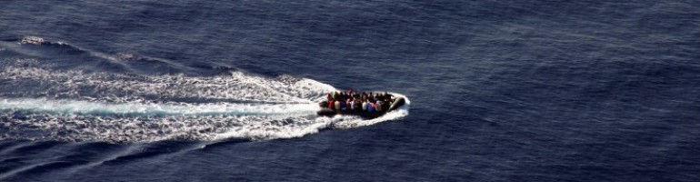
While the use by Frontex of satellite imagery is not new, Frontex released a copy of a satellite image used last week to detect and rescue 370 people on 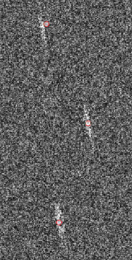 board three inflatable boats off the Libyan coast. (It is unclear whether the image made available by Frontex shows the actual spatial resolution available to Frontex.)
According to Frontex, the imagery is part of “Frontex’s Eurosur Fusion Services … made possible by the cooperation between experts at Frontex and the European Maritime Safety Agency (EMSA), Italian authorities and EUNAVFORMED. … The Eurosur [fusion] services already include automated large vessel tracking and detection capabilities, software functionalities allowing complex calculations for predicting positions and detecting suspicious activities of vessels, as well as precise weather and oceanographic forecasts. Fusion Services use optical and radar satellite technology to help locate vessels at sea. Recent upgrades of their technical capabilities make it possible to spot smaller vessels.”
Frontex has used satellite imagery for years, for example in 2008 during Frontex Operation Hera off Mauritania, Amnesty International reported that satellite photos would be presented to Mauritanian authorities to demonstrate that migrants on board a particular migrant boat had departed from Mauritania territory. (Amnesty International, “Mauritania: ‘Nobody Wants to Have Anything to Do With Us,’ Arrests and Collective Expulsions of Migrants Denied Entry Into Europe,” 1 July 2008.)


